SMOS: Soil Moisture and Ocean Salinity (ESA)
ESA’s SMOS satellite, launched in 2009, was the first mission to map soil moisture and ocean salinity worldwide. Its data now help track long-term droughts.
✨ New solutionAdded
Image: DLR, via Wikimedia Commons (CC BY 2.0). A scale model of SMOS.
Last reviewed: 2 sources cited
Explain Like I'm 10
- SMOS is a European satellite that has been circling Earth since 2009.
- It measures how wet the soil is on land and how salty the ocean is.
- Scientists use its data to watch droughts and to improve weather forecasts.
The Five W's of SMOS (ESA)
Who
The European Space Agency runs SMOS as one of its Earth Explorer missions.
Source: ESA Earth Online, SMOS
What
SMOS is the first mission to map soil moisture over land and sea surface How salty water is. Saltier water is heavier, so differences in salinity help drive ocean currents. Glossary over the oceans worldwide, using L-band microwave measurements. Its instrument has 69 antenna receivers.
Sources: ESA Earth Online, SMOS; ESA, SMOS
When
It launched on 2 November 2009. Designed as a five-year mission, its operations were extended because of its excellent technical and scientific performance.
Source: ESA Earth Online, SMOS
Where
In a sun-synchronous polar The curved path an object takes as it travels around a planet, moon or star, like a satellite circling Earth. Glossary, about 758 km above Earth on average.
Sources: ESA, SMOS; ESA Earth Online, SMOS
Why
Soil moisture and ocean salinity are two key parts of the water cycle. Both are vital for climate models, and SMOS helps improve weather and extreme-event forecasting.
Source: ESA Earth Online, SMOS
Impact Statement
Agency solution · active · New solution
SMOS passed its 15-year milestone in orbit in 2025, three times its five-year design life.
Sources: ESA, SMOS; ESA Earth Online, SMOS
Scientists have used SMOS data to build a soil moisture index that could serve as a tool to monitor long-term droughts globally.
How This Improves Our Planet’s Health
Watching the planet’s water cycle
By consistently mapping soil moisture and ocean salinity, SMOS is advancing understanding of how water moves between Earth’s surface and the atmosphere, and it helps improve weather and climate models.
Source: ESA, SMOS
Early signs of drought
As climate change drives drier and hotter conditions, scientists have used SMOS data to build a soil moisture index that could serve as a tool to monitor long-term droughts globally.
Source: ESA Earth Online, SMOS
Forests and ice
ESA reports that long-term SMOS data can help estimate how much carbon is stored in forests, and that SMOS contributes significant information to research on Earth’s frozen regions.
Sources: ESA, SMOS; ESA Earth Online, SMOS
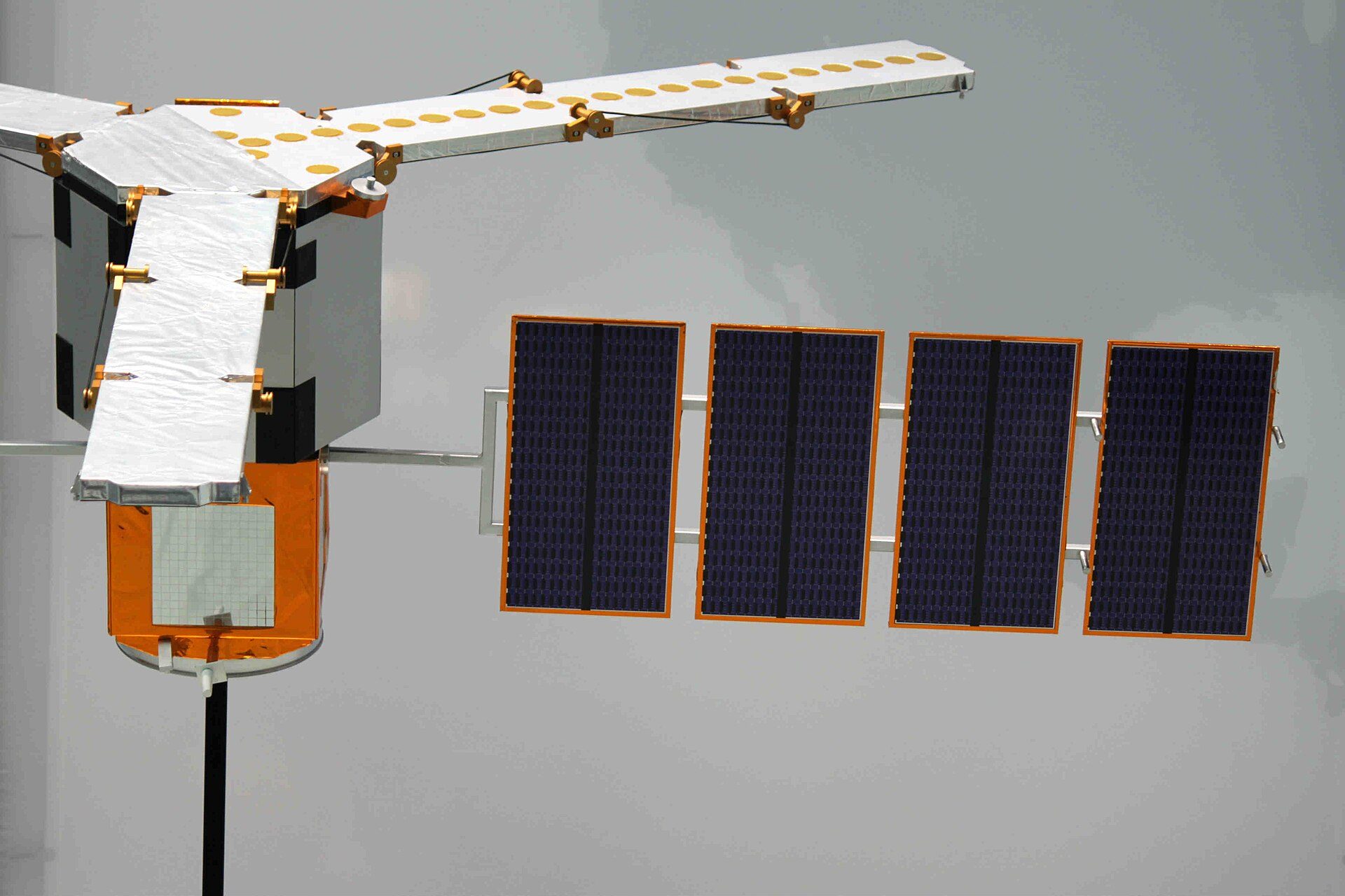
Image: DLR, via Wikimedia Commons (CC BY 2.0). A scale model of SMOS.
Learn About SMOS (ESA)
Want to go deeper? The official page has the full details behind the numbers here.
For Further InformationRelated Solutions
More solutions like this one, matched by meaning.
Help This Work
SMOS is a European Space Agency mission, so there is no Donate button. Saving Planets is showcasing it, not partnering with ESA.