National Snow and Ice Data Center (NSIDC)
NSIDC tracks Earth’s ice. Arctic sea ice hit its 2026 minimum of 4.60 million km² on Sept 12, and the last 20 years are the 20 lowest on record.
✨ New solutionAdded
Image: NASA Scientific Visualization Studio (public domain). Arctic sea ice at its September 10, 2025 minimum, built from satellite data.
Last reviewed: 3 sources cited
Explain Like I'm 10
- Frozen seawater that floats on the ocean surface. It grows in the polar winter and shrinks in summer. Glossary is frozen ocean water that floats at the top and bottom of the world.
- Scientists at NSIDC in Colorado use satellite data to measure how much there is.
- In 2026 the Arctic’s summer ice shrank to one of its smallest sizes since satellites started watching.
The Five W's of NSIDC: Watching Earth’s Sea Ice
Who
The National Snow and Ice Data Center is part of CIRES at the University of Colorado Boulder. It has studied Earth’s frozen regions since 1976.
Source: NSIDC, About
What
NSIDC scientists track sea ice with satellites. They found Arctic sea ice likely reached its 2026 minimum of 4.60 million square kilometers (1.78 million square miles) on September 12.
When
The 2026 minimum ranks tenth lowest in the nearly 48-year satellite record, tied with 2008, 2010 and 2025. In the Antarctic, sea ice likely peaked on September 14, 2026.
Where
Both poles. Antarctic sea ice likely peaked at 17.59 million square kilometers, which would be the third lowest maximum on record if that date holds.
Why
NSIDC says the last 20 years are the 20 lowest Arctic sea ice extents in the satellite record. Senior scientist Walt Meier said this year’s minimum is far lower than anything seen in the 1980s, 1990s and early 2000s.
Impact Statement
Agency solution · active · New solution
The last 20 years are the 20 lowest Arctic sea ice extents in the nearly 48-year satellite record, and NSIDC publishes these numbers openly.
Source: NSIDC, Arctic sea ice minimum 2026
NSIDC director Mark Serreze said that despite a fairly cool Arctic Ocean summer in 2026, there was loose ice all the way to the pole.
How This Improves Our Planet’s Health
Keeping the planet’s air conditioner on watch
NSIDC explains that Arctic sea ice acts like the planet’s air conditioner: its bright, white surface reflects sunlight back into space. As ice retreats, the darker open ocean absorbs more of the Sun’s energy. Tracking the ice shows how fast that cooling shield is changing.
Source: NSIDC, Why sea ice matters
Protecting ice-dependent wildlife
NSIDC cites the Arctic Monitoring and Assessment Programme’s 2017 report: expected reductions in sea ice will drastically shrink habitat for ice-dependent seals, polar bears and some seabirds. Open, trusted data lets scientists and decision-makers see those changes early.
Source: NSIDC, Why sea ice matters
For people
NSIDC publishes its sea ice analyses openly, so classrooms, journalists and researchers can all use the same record.
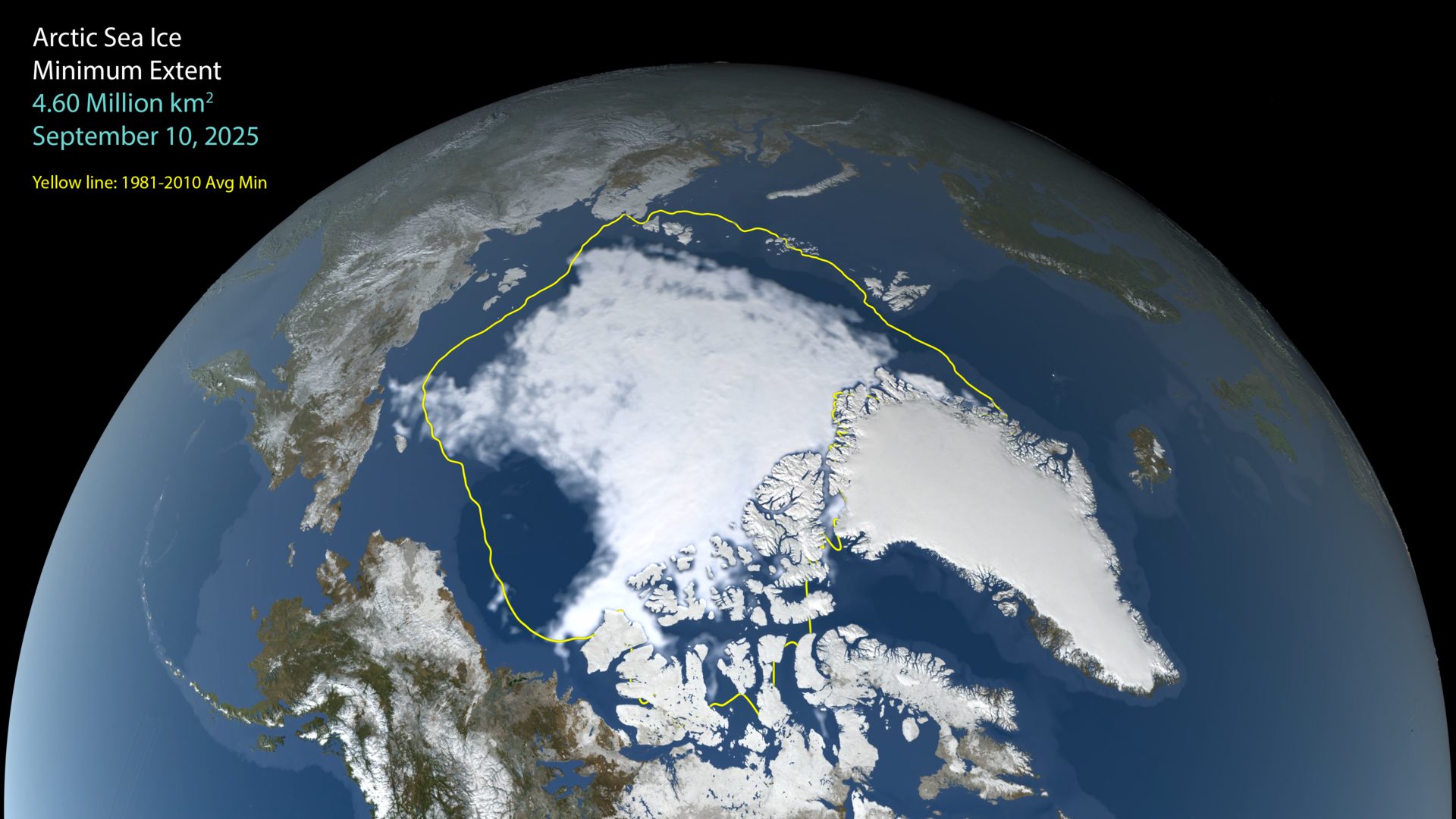
Image: NASA Scientific Visualization Studio (public domain). Arctic sea ice at its September 10, 2025 minimum, built from satellite data.
Learn About NSIDC: Watching Earth’s Sea Ice
Want to go deeper? The official page has the full details behind the numbers here.
For Further InformationRelated Solutions
More solutions like this one, matched by meaning.

Help This Work
NSIDC is a university research center, so there is no Donate button. Saving Planets is showcasing its work, not partnering with it.