North Aral Sea and the Kok-Aral Dam
A 13 km dike finished in August 2005 held the North Aral Sea. It reached its design level in two years instead of the expected ten, and fish catches climbed from 52 tons to 2,000 tons.
Image: MODIS Land Rapid Response Team, NASA GSFC, 11 October 2019 (public domain). Source.
Last reviewed: 3 sources cited
Explain Like I'm 10
- The Aral Sea shrank, and the northern part became too salty for fish.
- Kazakhstan and the World Bank built a 13-kilometer dike to hold the northern sea.
- The water rose faster than planned, and fishers started catching fish again.
The Five W's of the North Aral Sea
Who
The government of Kazakhstan and the World Bank built the Syr Darya and Northern Aral Sea project, including the Kok-Aral Dam.
What
A 13-kilometer dike separates the northern Aral Sea from the southern part and holds the Syr Darya’s water in the north. The project cost $86 million, including a $64.5 million World Bank loan. The dike was completed in August 2005.
When
Planners expected the northern sea to take about 10 years to fill. It reached the design level of 42 meters above Baltic Sea level two years after the Kok-Aral Dam was finished, and then stayed near that level.
Where
The dam is on the North Aral Sea in Kazakhstan. By 2007 the shoreline, once about 100 km from the former port of Aralsk, was about 25 km away.
Why
Before the dike, the northern sea had dried and become too salty for fish. Freshwater inflow then halved the salinity to less than 10 grams per liter by 2007, and the water surface became about 50% larger than it had been at its lowest level.
Impact Statement
Agency solution · active
Fish catches in the northern sea rose from 52 tons in 2004 to 2,000 tons in 2007 after the dike refilled the sea and made it less salty.
Source: World Bank, 19 June 2008 announcement
The North Aral Sea reached 42 meters above Baltic Sea level two years after the Kok-Aral Dam, not the 10 years that had been expected.
How This Saves People & the Planet
For People
The returning shoreline brought water supply closer to Aralsk. The World Bank brief says the shore moved from about 100 km away to about 25 km, and new supply systems brought better water to the town and nearby villages.
Source: World Bank, Kazakhstan results brief
For Nature
By 2007, salinity in the North Aral Sea had been halved to less than 10 grams per liter, and the water surface was about 50% greater than at its lowest level. Several freshwater fish returned.
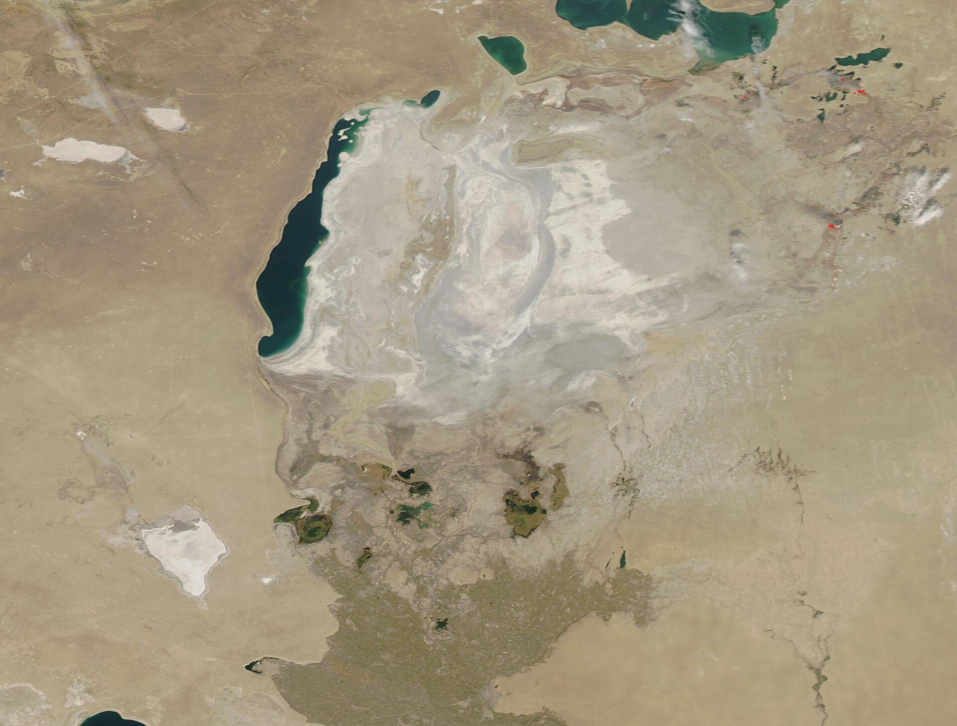
Image: MODIS Land Rapid Response Team, NASA GSFC, 11 October 2019 (public domain). Source.
Learn About the North Aral Sea Project
Want to go deeper? The World Bank’s 2008 announcement and the Kazakhstan results brief have the dike, the fish catch, and the shoreline.
For Further InformationHelp This Work
This was a government and World Bank project, so there is no donate button. The numbers above are from World Bank project documents.